-45%   PROMOZIONE

Carta da parati: Top view aerial of nguyen van linh road, area phu my hung new

Carta da parati Top view aerial of Nguyen Van Linh road, area Phu My Hung new urban, Ho Chi Minh City with development buildings, transportation, energy power infrastructure. Financial  in developed Vietnam.
Carta da parati:
Top view aerial of Nguyen Van Linh road, area Phu My Hung new urban, Ho Chi Minh City with development buildings, transportation, energy power infrastructure. Financial in developed Vietnam..
Autore: ©
Numero della foto:
#205411527
Altri argomenti:
carta da parati, Vietnam, Vietnam, urbano, viaggi, traffico, torre, turismo, top
Visualizzazione del prodotto
Simile
Top view aerial photo from flying drone of a Ho Chi Minh City with development buildings, transportation, energy power infrastructure. Financial and business centers in developed Vietnam.
Top view aerial of Thu Thiem peninsula and center Ho Chi Minh City  with development buildings, transportation, energy power infrastructure. Financial and business centers in developed Vietnam
Aerial view of Nhat Tan bridge in Ha Noi, Vietnam. Nhat Tan Bridge is a bridge crossing the Red River. Panorama
Top view aerial of center Ho Chi Minh City and Saigon bridge with development buildings, transportation, energy power infrastructure. Financial and business centers in  Vietnam. View from District 2
Top view aerial of Ho Chi Minh City, Vietnam with Nhieu Loc - Thi Nghe canal and Tan Son Nhat airport, with development buildings, transportation, energy power infrastructure. View from District 3
Top view aerial of Thu Thiem peninsula and center Ho Chi Minh City  with development buildings, transportation, energy power infrastructure. Financial and business centers in developed Vietnam
HO CHI MINH, VIETNAM - FEB 25, 2019: Top view aerial of Ha Noi highway and Cat Lai crossroads, Ho Chi Minh City with development buildings, transportation, infrastructure, Vietnam.
Top view aerial photo from flying drone of a Ho Chi Minh City with development buildings, transportation, energy power infrastructure. Financial and business centers in developed Vietnam.
Top view aerial of center Ho Chi Minh City and Saigon bridge with development buildings, transportation, energy power infrastructure. Financial and business centers in  Vietnam. View from District 2
Top view aerial of " Tram 2 " overpass, intersection of 1A national road with Hanoi highway. Ho Chi Minh City, Vietnam. View from district 9 to Dong Nai
Aerial panoramic cityscape view of HoChiMinh city and the Nhieu Loc canar , Vietnam with blue sky at sunset.
Panorama, Aerial view of Tan Long island or Con Tan Long in Tien Giang, Vietnam. Near My Tho city. Mekong Delta. Near Ben Tre
Top view aerial of Mai Chi Tho road, Thu Thiem peninsula and center Ho Chi Minh City, Vietnam  with development buildings, transportation, energy power infrastructure. View from District 2
Top view aerial of Ho Chi Minh City, Vietnam with Nhieu Loc - Thi Nghe canal and Tan Son Nhat airport, with development buildings, transportation, energy power infrastructure. View from District 3
Top view aerial of Thu Thiem peninsula and center Ho Chi Minh City  with development buildings, transportation, energy power infrastructure. Financial and business centers in developed Vietnam
Top view aerial of center Ho Chi Minh City and Saigon bridge with development buildings, transportation, energy power infrastructure. Financial and business centers in  Vietnam. View from District 2
Aerial view of new residential area in District 2, center Ho Chi Minh city with development buildings, transportation, energy power infrastructure, Financial and business centers in developed Vietnam
Top view aerial of " Tram 2 " overpass, intersection of 1A national road with Hanoi highway. Ho Chi Minh City, Vietnam. View from district 9 to Dong Nai
Aerial panoramic cityscape view of HoChiMinh City and Phu Dong roundabout or " Nga Sau Phu Dong" , Vietnam with blue sky at sunset.
Aerial view of Nhat Tan bridge in Ha Noi, Vietnam. Nhat Tan Bridge is a bridge crossing the Red River. Panorama
Hanoi Flag Tower, Hanoi, Vietnam
aerial view, anchored, architecture, background, ben tre, boats, buildings, business, center, city, cityscape, commercial, company, construction, contemporary, corporate, cruise ship, cruise terminal,
Top view aerial of Tan Thuan Export Processing Zone and center Ho Chi Minh City, Vietnam  with development buildings, transportation, energy power infrastructure. View from District 2
Top view aerial of Ha Tien City with development buildings, transportation, energy power infrastructure. Famous tourist city of Vietnam, sharing the border with Cambodia
Top view aerial view of Ninh Kieu Wharf, Can Tho City, Vietnam with development buildings, transportation, energy power infrastructure.
Top view aerial of center Ho Chi Minh City and Saigon bridge with development buildings, transportation, energy power infrastructure. Financial and business centers in  Vietnam. View from District 2
Traffic in the city center, cityscape of Yangon, Myanamar
Top view aerial photo from flying drone of a Ho Chi Minh City with development buildings, transportation, energy power infrastructure. Financial and business centers in developed Vietnam.
Top view aerial of Le Quy Don school, Ho Chi Minh City with development buildings, transportation, energy power infrastructure. Financial and business centers in developed Vietnam
Aerial view of Gieng Nuoc Lon lake in park of  My Tho town center. Tien Giang, Vietnam. Mekong Delta. Near Ben Tre
Panorama, aerial view of My Tho city center and tourist pier in My Tho city, Vietnam. Mekong Delta. Near Ben Tre
Panorama of Ha Long City, Vietnam, with Sun World Halong park and Bai Chay bridge. Near Halong Bay, UNESCO World Heritage Site. View from Bai Chay bridge to Cam Pha
Top view aerial photo from flying drone of a Da Nang City with development buildings, transportation, energy power infrastructure. Financial and business centers in developed Vietnam.
Royalty high quality free stock image aerial view of center city, Dalat, VIetnam
Cao dang su pham Da Lat or Pedagogical College Dalat or Lycee Yersin School in Dalat, Vietnam. The school was founded in 1927 in Dalat to educate the children of French colonialists
Royalty high quality free stock image aerial view of center city, Dalat, VIetnam
Cao dang su pham Da Lat or Pedagogical College Dalat or Lycee Yersin School in Dalat, Vietnam. The school was founded in 1927 in Dalat to educate the children of French colonialists
Royalty high quality free stock image aerial view of center city, Dalat, VIetnam
Top view aerial photo from flying drone of a Da Lat City with development buildings, transportation. Tourist city in developed Vietnam. Mai Anh Dao street, ward 8, near Love Valley park.
Top view aerial photo from flying drone of a Da Lat City with development buildings, transportation. Tourist city in developed Vietnam. Da Lat palace hotel

Top view aerial photo from flying drone of a Da Lat City with development buildings, transportation. Tourist city in developed Vietnam.

Top view aerial photo from flying drone of a Da Lat City with development buildings, transportation. Tourist city in developed Vietnam.

Top view aerial photo from flying drone of a Da Lat City with development buildings, transportation. Tourist city in developed Vietnam.

Top view aerial photo from flying drone of a Da Lat City with development buildings, transportation. Tourist city in developed Vietnam.

Top view aerial photo from flying drone of a Da Lat City with development buildings, transportation. Tourist city in developed Vietnam.
Top view aerial photo from flying drone of a Da Lat City with development buildings, transportation. Tourist city in developed Vietnam. Center Square of Da Lat city
Top view aerial photo from flying drone of a Da Lat City with development buildings, transportation. Tourist city in developed Vietnam. Xuan Huong lake
Royalty high quality free stock image aerial view of center city, Dalat, VIetnam

Top view aerial photo from flying drone of a Da Lat City with development buildings, transportation. Tourist city in developed Vietnam.

Top view aerial photo from flying drone of a Da Lat City with development buildings, transportation. Tourist city in developed Vietnam.

Top view aerial photo from flying drone of a Da Lat City with development buildings, transportation. Tourist city in developed Vietnam.
Top view aerial photo from flying drone of a Da Lat City with development buildings, transportation. Tourist city in developed Vietnam. Xuan Huong lake
Royalty high quality free stock image aerial view of center city, Dalat, VIetnam
leggi di piùnascondi
Materiali

Carta da parati in vinile

La carta da parati in vinile è stampata su un fondo resistente con una superficie liscia e opaca. Grazie agli inchiostri HP Latex, i colori della carta da parati rimarranno vividi per molti anni.

  • ✓ Resistente alla deformazione e alle trazioni
  • ✓ Permeabile al vapore acqueo
  • ✓ Installazione facile
  • ✓ Inchiostro ecologico HP Latex

Larghezza massima del foglio: 95-105 cm. Nel caso in cui la dimensione da coprire superi la larghezza massima, la stampa consisterà di più fogli uguali.
Applicazione: pareti lisce e regolari
Metodo di installazione: Applichiamo la colla esclusivamente sulla superficie della parete e fissiamo i fogli seguenti bordo a bordo, un accorgimento che riduce il rischio di danni alla carta da parati e permette una maggiore precisione nel suo montaggio.
Metodo di pulizia: panno asciutto
Rifinitura: semiopaca


Carta da parati in vinile lavabile

La carta da parati in vinile lavabile è stampata su un fondo resistente, con una superficie liscia e opaca, e poi viene ricoperta con una pellicola laminata che impedisce l'azione dell’umidità e l'impatto negativo degli altri fattori esterni (graffi, abrasioni, esposizione al sole). La moderna tecnologia di stampa HP Latex garantisce colori vividi per un lungo periodo di tempo.

  • ✓ Rivestita di una pellicola laminata
  • ✓ Resistente all'umidità, graffi, abrasioni e all'impatto del sole
  • ✓ Resistente alla deformazione e alle trazioni
  • ✓ Permeabile al vapore acqueo
  • ✓ Facile installazione
  • ✓ Inchiostro ecologico HP Latex

Larghezza massima del foglio: 95-105 cm. Nel caso in cui la dimensione da coprire superi la larghezza massima, la stampa consisterà di più fogli uguali.
Applicazione: pareti lisce e regolari. Per spazi con un alto tasso di umidità (cucina, bagno), che sono soggetti a graffi (ingresso, camera dei bambini, hotel, ristoranti, sale per conferenze, edifici pubblici, scuole, asili e asili nido)
Metodo di installazione: Applichiamo la colla esclusivamente sulla superficie della parete e fissiamo i fogli seguenti bordo a bordo, un accorgimento che riduce il rischio di danni alla carta da parati durante i lavori interni e rende anche possibile una maggiore precisione nel suo montaggio.
Metodo di pulizia: panno bagnato
Rifinitura: semiopaca


Carta da parati in vinile strutturale

La carta da parati in vinile strutturale è stampata su un fondo resistente con una struttura di sabbia fine. Questa rifinitura permette di ottenere un particolare risalto del senso di profondità della stampa. La tecnologia di stampa HP Latex permette di mantenere colori vividi per molti anni.

  • ✓ Struttura di sabbia fine
  • ✓ Resistente alla deformazione e alle trazioni
  • ✓ Permeabile al vapore acqueo
  • ✓ Facile installazione
  • ✓ Inchiostro ecologico HP Latex

Larghezza massima del foglio: 100 cm. Nel caso in cui la dimensione da coprire superi la larghezza del materiale, la stampa consisterà di più fogli uguali.
Applicazione: pareti lisce e regolari. La carta da parati avrà una buona riuscita sia in interni destinati ad abitazioni che in ristoranti, scuole o uffici.
Metodo di installazione: Applichiamo la colla esclusivamente sulla superficie della parete e fissiamo i fogli bordo a bordo, un accorgimento che riduce il rischio di danni alla carta da parati e rende anche possibile una maggiore precisione nel suo montaggio.
Metodo di pulizia: panno asciutto
Rifinitura: semiopaca, struttura di sabbia fine

Carta da parati in vinile strutturale lavabile

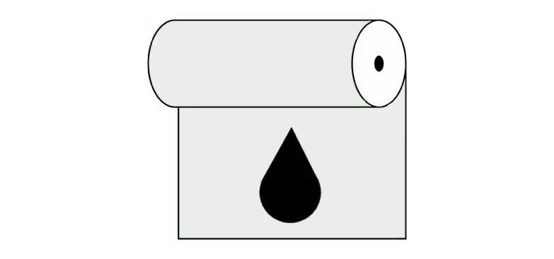
La carta da parati in vinile è stampata su un fondo resistente con una struttura di sabbia fine, che permette di ottenere un particolare risalto del senso di profondità della stampa. La tecnologia di stampa HP Latex permette di mantenere colori vividi per molti anni.

  • ✓ Rivestita di pellicola laminata
  • ✓ Struttura di sabbia fine
  • ✓ Resistente all'umidità, graffi, abrasioni e all'impatto del sole
  • ✓ Resistente alla deformazione e alle trazioni
  • ✓ Permeabile al vapore acqueo
  • ✓ Facile installazione
  • ✓ Inchiostro ecologico HP Latex

Larghezza massima del foglio: 100 cm. Nel caso in cui la dimensione da coprire superi la larghezza del materiale, la stampa consisterà di più fogli uguali.
Applicazione: pareti lisce e regolari. Per la decorazione di spazi con un alto tasso di umidità (cucina, bagno) e anche di superfici esposte alle abrasioni (ingresso, camera dei bambini, hotel, ristoranti, sale per conferenze, edifici pubblici, scuole, asili e asili nido)
Metodo di installazione: Applichiamo la colla esclusivamente sulla superficie della parete, un accorgimento che riduce il rischio di danni alla carta da parati durante i lavori negli interni e rende anche possibile una maggiore precisione nel suo montaggio.
Metodo di pulizia: panno umido
Rifinitura: semiopaca, struttura di sabbia fine

Carta da parati autoadesiva

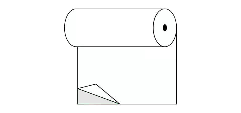
Grazie alla sua applicazione estremamente versatile, funziona benissimo in vari tipi di ambiente e superfici diverse. Le carte da parati autoadesive sono perfette sia quando sono montate sulle pareti di casa, così come sugli armadi, i vetri delle finestre, sui mobili e su altre superfici lisce. La tecnologia di stampa HP Latex assicura dei colori chiari e vividi per molti anni.

  • ✓ Nessuna colla aggiuntiva
  • ✓ Metodo di installazione molto semplice e veloce
  • ✓ Resistente alla deformazione e alle trazioni
  • ✓ Permeabile al vapore acqueo
  • ✓ Inchiostro ecologico HP Latex

Larghezza massima del foglio: 133 cm. Nel caso in cui la dimensione da coprire superi la larghezza massima del materiale, la stampa consisterà di più fogli uguali.
Applicazione: superfici lisce, applicazione universalmente
Metodo di installazione: bordo a bordo
Metodo di pulizia: panno umido
Rifinitura: semiopaca


leggi di piùnascondi
Controlla anche
Vista aerea di Hon Ga Choi Island (Fighting Cocks Island), o Trong Mai Island (Cock and Hen Island), Halong Bay, Vietnam, Sud-est asiatico. Patrimonio mondiale dell'UNESCO. Crociera in junk boat per l
Aerial view of Linh Ung Pagoda with a giant buddha statue among green trees on the top of Ba Na mountain, Da Nang, Vietnam
Aerial view of landscape is castles covered with fog at the top of Bana Hills, the famous destination of Da Nang, Vietnam
Linh Phong tower on top of Ba Na Nui Chua, Ba Na Mountain. Next to  " Linh Phong Tu " temple, Bia houses, Ba temple and Lau Chuong ( steeple ). Da Nang, Vietnam
Aerial view of landscape is castles covered with fog at the top of Bana Hills, Da Nang, Vietnam
Aerial view of landscape is castles covered with fog at the top of Bana Hills, the famous destination of Da Nang, Vietnam

Nasz sklep internetowy używa plików cookies i pokrewnych technologii. Dzięki nim zapewniamy najwyższą jakość świadczonych usług i gwarantujemy płynne działanie strony. Po uzyskaniu Twojej zgody, pliki cookies będą również wykorzystane do dodatkowych pomiarów i analizy korzystania z witryny. Pozwoli nam to dostosować stronę do Twoich zainteresowań oraz prezentować spersonalizowane treści i reklamy.
Administratorem Twoich danych jest Fairbox Sp. z o.o., a w niektórych sytuacjach także nasi partnerzy, z którymi współpracujemy. Szczegółowe informacje dotyczące korzystania z plików cookie oraz przetwarzania Twoich danych osobowych znajdziesz w naszej Polityce Prywatności i Cookies.
Ustawienia plików cookies
Poniżej znajdziesz opisy poszczególnych kategorii plików cookies oraz możliwość dostosowania ich do swoich preferencji: